How Does A La Nina Impact Weather In New York?
Meteorologists are calling for a triple "La Nina" this winter and it will have an impact on the weather we will see here in New York.
Feel Good Mornings With Dave Fields Mon-Fri 6am-10am
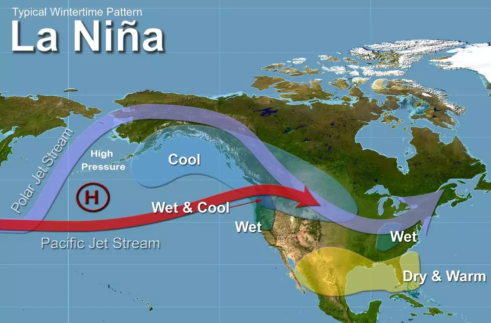
WHAT IS A LA NINA?
A "La Nina" is the periodic cooling of ocean surface temperatures in the central and east-central parts of the Pacific.
WHAT IS A TRIPLE DIP LA NINA?
The term triple dip La Nina refers to a La Nina impacting three years in a row. Usually, La Ninas impact the United States once 3 to 5 years, but this year we will see a La Nina for the third straight year. This current pattern of La Ninas started in September 2020.

HOW WILL THE TRIPLE DIP LA NINA IMPACT WEATHER IN NEW YORK?
Usually, when a La Nina moves across the country, it brings cooler temperatures and more snow than normal. So what does that mean for New York's weather? It looks like this winter we will have more snow than average. Last year Buffalo got 97.4 inches of snow which were two more inches than normal. Elsewhere across the state, most cities got less than average snowfall in 2021. With another La Nina coming across the state, we are expected to see more snow and colder temperatures than average.
IT IS NORMAL FOR A TRIPLE DIP LA NINA?
The simple answer is no. This "triple dip" La Nina is the first one we have seen this century. So the weather we will see this fall and winter could be weather most of us have never seen in our lifetime.
KEEP READING: Get answers to 51 of the most frequently asked weather questions...
LOOK: The most expensive weather and climate disasters in recent decades
Gallery Credit: KATELYN LEBOFF
5 Very Buffalo Ways To Predict The Weather
Gallery Credit: Dave Fields

More From 93.7 WBLK