Buffalo’s 5 Poorest Neighborhoods
As we dig farther into the data that was collected as apart of the 2020 US Census, we are learning more about how Buffalo's economy is doing over time, along with how those changes are going when compared to the larger economy.
While Buffalo has seem some marked financial improvements when looking at the last few decades, the 716 area still ranks as one of the poorest cities in the United States of America.

Not only is Buffalo one of the most racially segregated cities in America, it is also one of the most economically segregated places in the country. That poverty in the Buffalo shoved evenly throughout our region. In some cases, Buffalo and Western New York is really the tale of two cities.
So, taking a much deeper look into New York's Census data can really be eye opening.
So What Neighborhoods Are Impacted?
The US Census Bureau breaks down every area in the country into what's called Census Tracts or small, relatively permanent statistical subdivisions of a county that generally have a population size between 1,200 and 8,000 people, with an optimum size of 4,000 people. Census tracts are tracked and identified by an 11-digit number that is assigned to each neighborhood or area.
A vast majority of the low-income Census Tracts in Erie County are within the City of Buffalo, while a vast majority of the upper-income Census Tracts are outside of the City.
According to the Census, the annual median income within the entire Buffalo-Cheektowaga-Niagara Falls, NY (MSA) is approximately $78,000, while the income in the 5 poorest neighborhoods in Buffalo doesn't surpass $29.000 per year.
Buffalo's Upper West Side Neighborhood
Census Tract 360290171.00 is located in the Northwest corner of Buffalo's Upper West Side and is roughly bounded by West Delavan Ave., Grant St, The Niagara River, and the Scajaquada Creek. This area is reported to have the highest percentage of residents who live below the Federal Poverty Level at 62.25% and has a median annual family income of $28,167.
Buffalo's Broadway Fillmore Neighborhood
Census Tract 36029027.04 is in the Broadway Fillmore neighborhood on Buffalo's east side and is roughly bounded by Fillmore Ave., Best St., Lathrop St, and Broadway. According to the data, 59.27% of the population lives below the Federal Poverty Level and the median annual income in the area is $23,512.
Buffalo's Kenfield Neighborhood
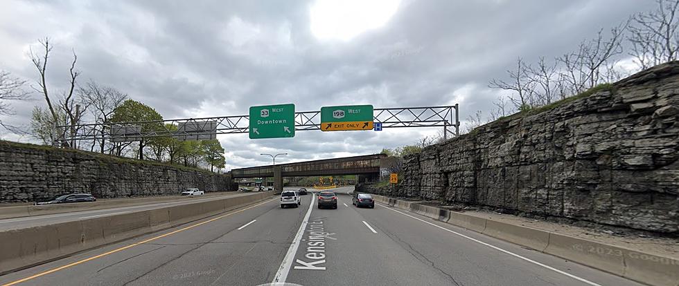
Census Tract 36029044.02 sits in the Kenfield neighborhood of Buffalo, just south of the Kensington Expressway, and is bounded by Bailey Ave., Weston Ave., and Eggert Rd., on Buffalo's far east side. This area which includes both the Langfield and Kenfield public housing projects has roughly 58.01% of its residents living below the Federal Poverty Level with a median annual income of $17,011.
Buffalo's Lower West Side
Census Tract 36029069.01 is on the Lower West Side of Buffalo just a few blocks from the Peace Bridge. This particular area is bounded by Vermont St., Brayton St., Hampshire St., and Fargo Ave. and has 55.3% of its residents living below the Federal Poverty Level. The residents earn a median annual income of approximately $26,637.
Buffalo's Lower West Side
Census Tract 36029070.00 is also on the Lower West Side and is adjacent to the Census Tract above, bounded by Fargo Ave., Porter Ave., and the Niagara River. This neighborhood includes the Peace Bridge Plaza and has a median annual income of $19,102 and 55.22% of its residents living below the Federal Poverty Level.
Top 10 Complaints From New York Consumers
Gallery Credit: Ed Nice
Micah Hyde's 3rd Annual Charity Softball Game
Gallery Credit: Ed Nice
More From 93.7 WBLK


